
C-MAP 4D Lakes NA-D073 North East [M-NA-D073-MS]
C-MAP 4D Lakes NA-D073 North East [M-NA-D073-MS]
Availability: Out of stock
Couldn't load pickup availability
Shipping & Returns
Shipping & Returns
We offer fast, reliable shipping for all your marine supply needs. Orders will ship the same day, Monday-Friday if placed before 4 pm EST.
Your satisfaction is our priority! We accept returns on most items in new, unused condition within 30 days of delivery.
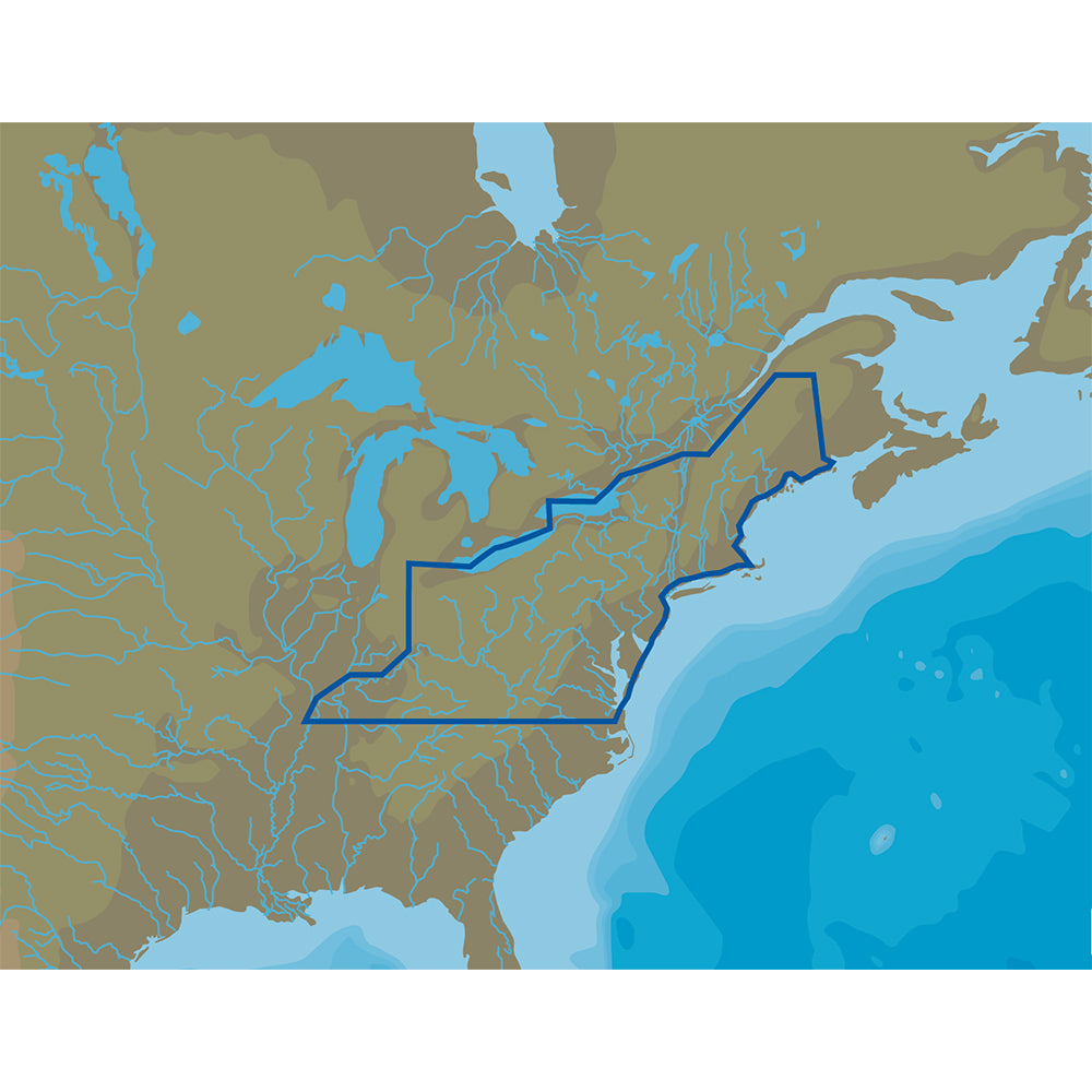
4D Lakes NA-D073 North East
C-MAP charts have long been held in high regard by boaters because they combine aesthetically pleasing vector electronic charts with reliable sources. With the backing of Jeppesen's parent company Boeing, a well-respected multibillion dollar global company, boaters can be assured that C-MAP charts are of the highest standard.
C-Map 4D will provide boaters with charts packed additional features such as raster chart views or Satellite images* to maximize situational awareness.
Coverage Area:
Lakes and major rivers of North East region of USA, including states of: Maine, Vermont, New York, New Jersey, New Hampshire, Massachuesetts, Connecticut, Delaware, Maryland, Virginia, West Virginia, Kentucky, Ohio, Pennsylvannia. Includes coastal coverage of Atlantic Ocean and Chesapeake Bay, Hudson River, Cape Cod, Long Island Sound, more.
Specifications:
- Card Format: MicroSD/SD
- Box Dimensions: 1"H x 5"W x 8"L WT: 0.2 lbs